

You look at a topographic map, and your brain immediately tries to translate those flat lines into a physical reality. You are trying to feel the grade, anticipate the sudden dip of a valley, or figure out the exact cut-and-fill for a route. The screen is two-dimensional, but the ground you are working with certainly isn't.
Sometimes you just need to slice open the earth and look at the cross-section. But getting a clean elevation profile shouldn't mean wrestling with crowded interfaces or sidebars that eat up half your viewport. You just want to see the rise and fall of the land.
That was the thought process behind the Geodesia Terrain Profile Tool. It is built to bridge the gap between the flat map and the actual topography, completely stripped of visual noise.
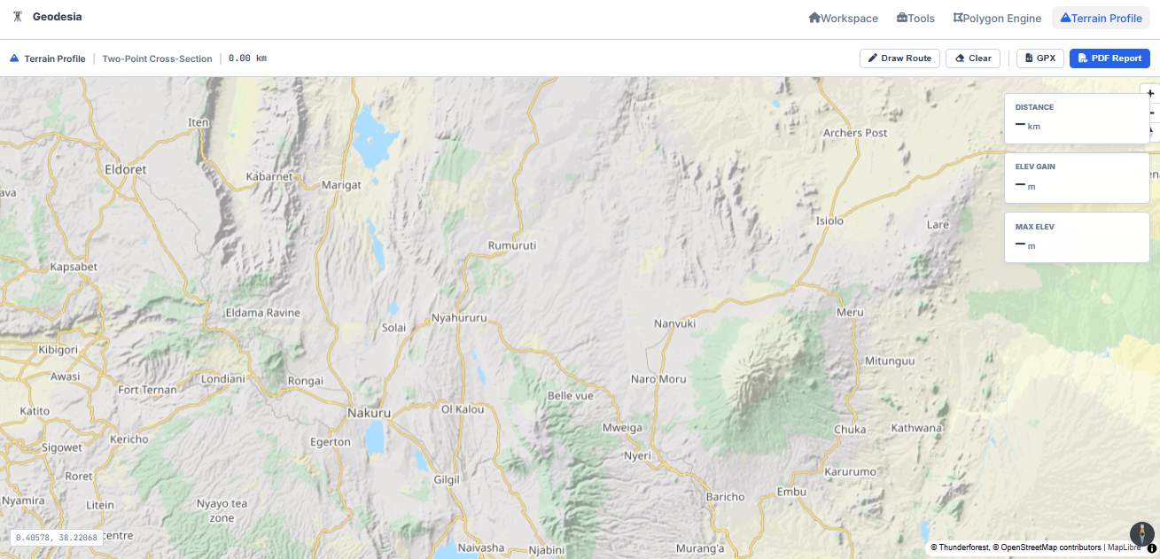
When you open the tool, the map is everything. There are no heavy menus in the way. If you just need a quick look at a gradient, you can drop a start and end point to immediately pull the cross-section. If you are tracking a more complex path—like a winding road or a pipeline—you just grab the draw tool and trace your route directly over the landscape.
As you trace, the bottom drawer glides up and builds the elevation chart in real time. You aren't left guessing where the steepest climbs are because the profile is entirely synced with the map. While you work, a floating panel quietly updates the exact metrics you actually care about: your total distance, the overall elevation gain, and the absolute maximum height along your path.
It is just you and the terrain. The interface even shifts automatically to match your system’s dark or light mode. Whether you are under the glaring midday sun or working late in a dark room, the screen just adapts and stays out of your way.
Once you have the profile dialed in, you don't have to leave the data sitting in the browser. You can instantly pull the raw GPX file to drop straight into your CAD environment, or generate a clean PDF report to attach to your field notes. Then you just clear the board and start the next route.
It’s a simple concept, but it respects the reality of the ground. You can try the Geodesia Terrain Profile Tool here.